

Vayk Winery Journal
Vayots Sar and the Ground Beneath MOZ
An Armenian volcano, the lost town of Moz and a red wine taking shape beside the Arpa River
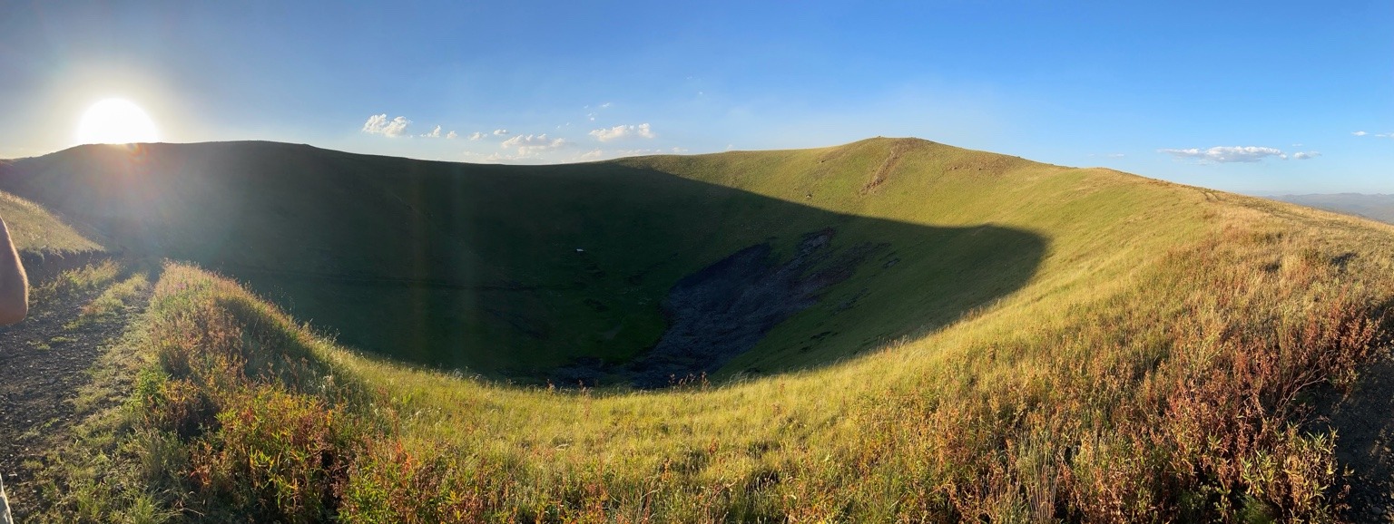
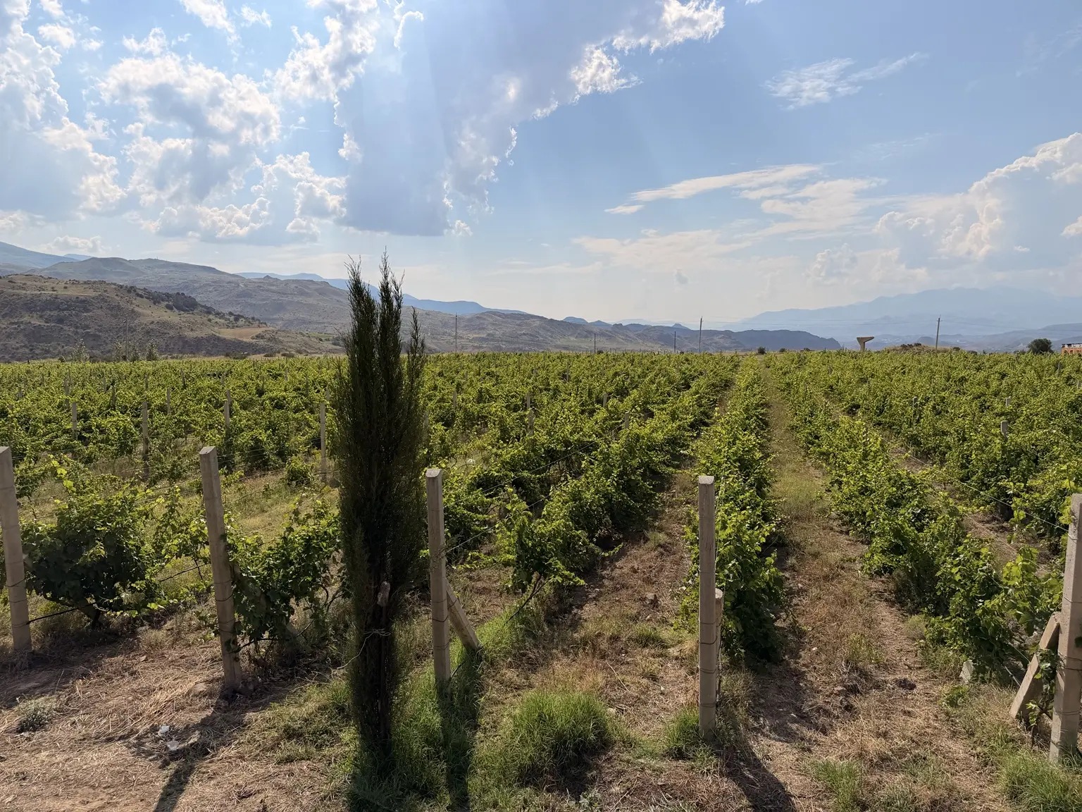
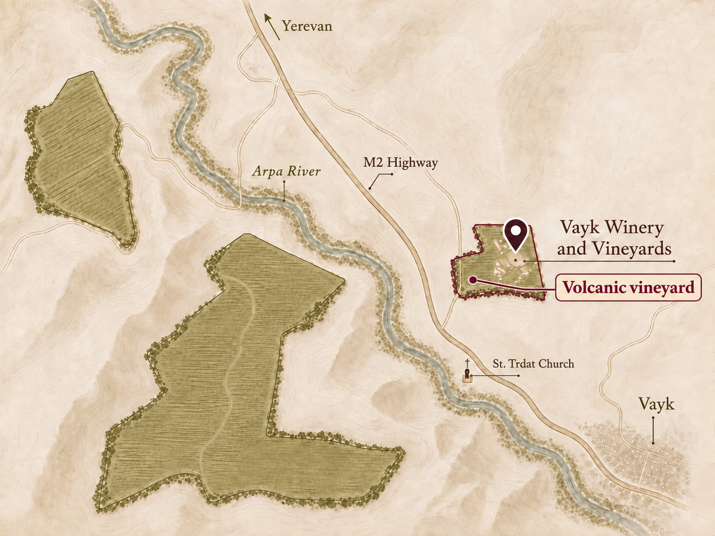
At Vayk Winery, Moz is part of the address before it is the name of a wine. Our winery stands at Moz 1, Vayk, on the right bank of the Arpa River in Armenia’s Vayots Dzor region. The approximately four-hectare site around it includes the volcanic vineyard from which we are developing MOZ, a red blend now maturing ahead of a planned first bottling in 2027.
The name reaches beyond the cellar. Moz was an old settlement in this valley, remembered in accounts of a catastrophe. Local stories connect its fate with Vayots Sar, the volcano to the north. They bring the mountain, the ruined town and the dark stone into a single dramatic event. Geological research tells a more complicated story, and gives the ground beneath the vines a much longer history.
Following that history means moving between different kinds of evidence: a medieval account of darkness, a Soviet geologist’s field observations, a modern measurement of volcanic age. Each preserves something worth knowing. Together, they help us understand the place whose name will go on the bottle.
The mountain also called Dalik
Vayots Sar appears under more than one name. Armenia’s official list of natural monuments records it as Vayots Sar, or Dalik. K. I. Karapetyan’s 1959 geological paper is titled Volcano Dalik and also uses the form Dali-Tapa. These older names are useful when following the mountain through Armenian and Russian publications; they refer to the same volcano. [1] [2]
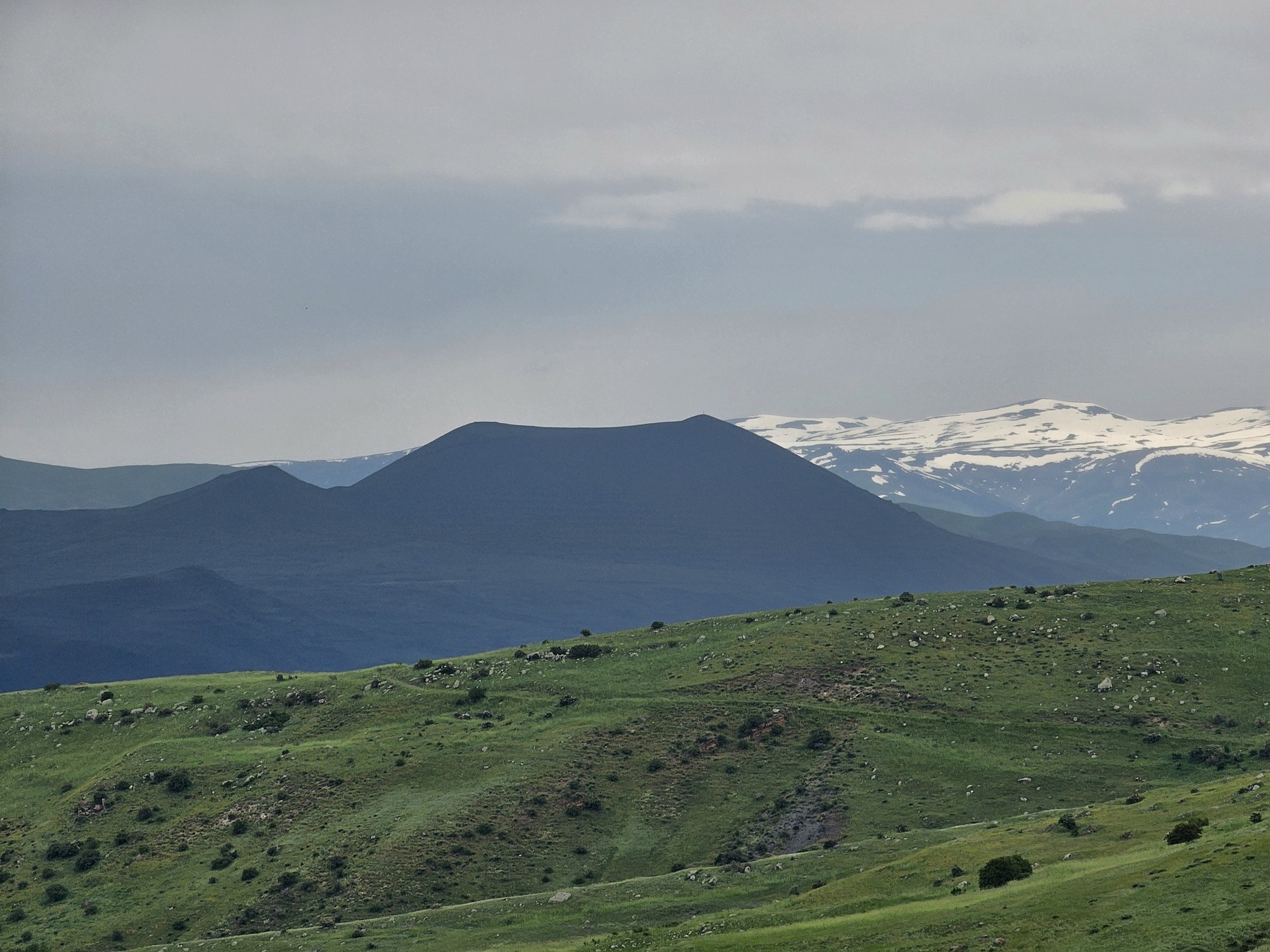
The Armenian Institute of Geological Sciences’ 2024 volcano catalogue places the summit at approximately 2,586 metres, with a crater up to 500 metres across and 100 metres deep. The cone consists of cinders, ash and other erupted fragments. Around its base, the story spreads out into lava flows. [3]
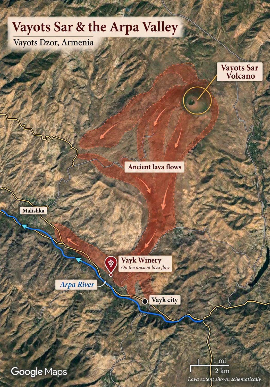
A volcano is more than the outline of its cone. The catalogue records lava tongues descending through the Arpa and Herher gorges, in places reaching the Arpa near the Yerevan–Goris road. It identifies basaltic trachyandesite and trachyandesite, specific volcanic rock types rather than a single undifferentiated “basalt.” [3]
Patrick Sugden and colleagues place Vayots Sar among the monogenetic volcanoes of the southern Lesser Caucasus. Such a volcano forms during one eruptive episode, although that episode can have several phases. Their 2021 study sets these smaller volcanic centres within the much larger history of the Arabia–Eurasia collision zone. The quiet cone belongs to a region shaped by processes extending far beyond this valley. [4]
Following the lava toward the river
The connection with the vineyard is easier to understand by following the lower ground than by looking only at the summit.
Soviet geologists were already tracing these routes in detail. A guide prepared for the First All-Union Volcanological Meeting in 1959 describes a southern lava flow travelling about 16 kilometres before continuing for roughly four kilometres along a terrace on the Arpa’s right bank. The account makes the river valley part of the volcano’s physical history. [5]
Later field research described lava from a fissure near Arin descending toward Vayk, obstructing the Arpa and continuing west along the valley. A map showing everything pouring from the summit in one uninterrupted sheet would miss this complexity. [9]
At Vayk Winery, the site discussed here is the small winery-side holding on the river’s right bank, distinct from our larger vineyards across the water. That distinction is easy to lose in a sweeping landscape photograph. It matters to MOZ, whose grapes come exclusively from this lava-remnant site. The wider Vayk Winery vineyard story provides the regional setting; this wine brings the attention down to one place.
Moz before and after the catastrophe
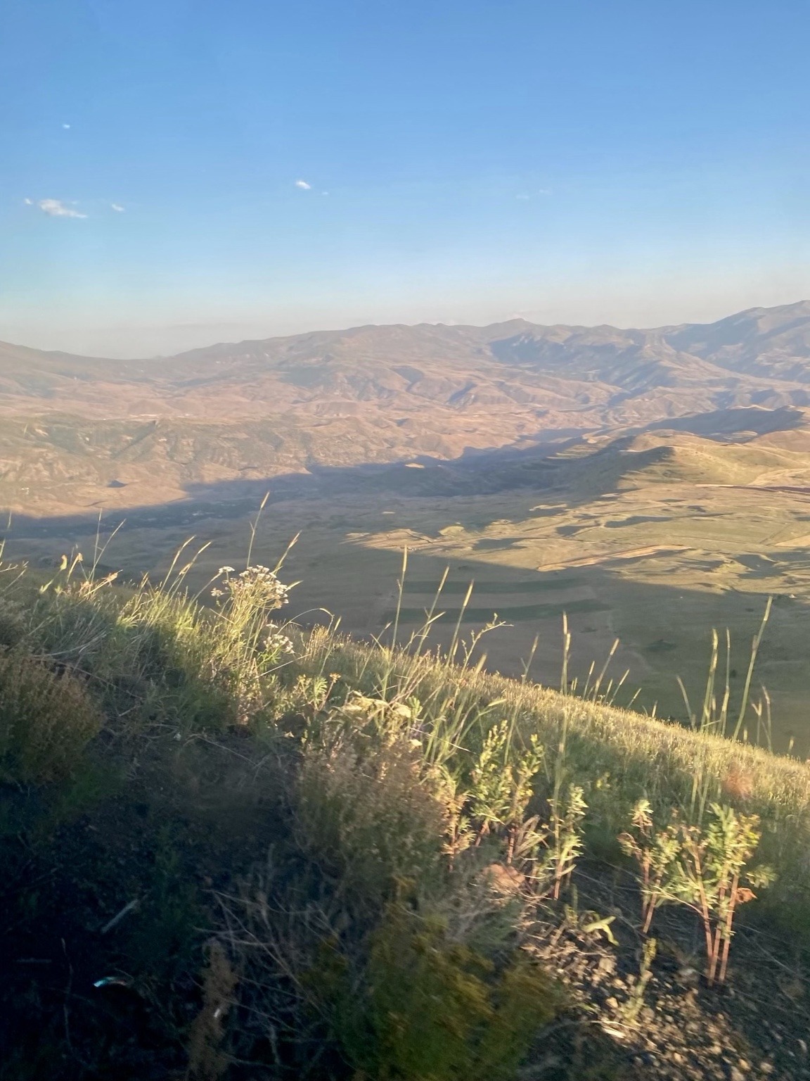
A 2021 geohazards and geopark atlas published by Armenia’s National Academy of Sciences locates the Moz geosite on the Arpa’s right bank, approximately 2.5 kilometres east of Malishka. Its illustrations identify remains of fortifications and a church, alongside Bronze and Iron Age burials. The settlement was a centre of trade and crafts in the seventh and eighth centuries, associated with the Silk Road. [6]
This gives Moz a history before the disaster. The town was a place where people worked and travelled, using ground that had already been shaped by volcanic activity. The atlas states explicitly that the old settlement was built on a lava flow. It also records later cross-stones, evidence that the story of human presence did not end neatly with a single eighth-century event. [6]
The catastrophe itself survives in Armenian chronicles. In their historical earthquake catalogue, Emanuela Guidoboni and Giusto Traina examine a destructive event in Vayots Dzor in 735 CE. The accounts describe collapsed buildings, landslides and changes to water supplies. They also describe darkness and shaking lasting forty days. Stepanos Orbelian’s thirteenth-century account, written centuries afterward, presents the disaster through the religious language of its time. [7]
It is easy to understand why readers standing among volcanic stones might connect such darkness with an eruption. That interpretation also entered scientific discussion. In a 2001 Armenian-language paper, R. A. Harutyunyan argued for volcanic activity accompanying the 735 earthquake, drawing on historical descriptions and earlier geological interpretations. The eruption story was therefore more than a tourist anecdote; it was a hypothesis that researchers debated. [8]
But darkness in a chronicle cannot by itself identify volcanic ash. Nor can a remembered catastrophe date the rock beneath a building. The relationship between town and lava has to be examined on the ground.
What the fieldwork changed
In a Russian-language paper published in 2004, Arkady Karakhanian and colleagues reported an important observation from their 2002 fieldwork: Moz’s buildings stood on the lava surface, and their masonry used fragments of the flow itself. A feature previously interpreted as an eruptive opening was instead described as a steep lava step, with streets and structures on it. These observations challenged the idea that this lava had engulfed the town in 735. [9]
If people built on a flow and used its stone, that flow was already there. This changes the sequence: the volcanic ground becomes the settlement’s foundation rather than automatically the agent of its destruction.
There is a revealing earlier detail. The 1959 excursion guide already referred to the account of Moz being covered by lava as a legend. Even within the Soviet geological literature, a local explanation and an observed rock relationship were not interchangeable. [5]
The connection with our own property needs the same care. Local accounts place Moz on or around the ground occupied by the winery today. Published studies establish the wider settlement’s location, but do not map its buildings against our present parcel boundary. We can preserve the local account without claiming an excavated town beneath each vineyard row.
A much older volcanic clock
Dating Vayots Sar has its own history. In his 1959 study, Karapetyan estimated an age of roughly 10,000 to 15,000 years using an assumed rate of regional uplift. That was an interpretation of the landscape, not an isotope measurement. It is useful evidence of how geologists approached the question with the information then available. [2]
A substantially older result appears in Khachatur Meliksetyan’s 2018 doctoral abstract. It places volcanic activity at Vayots Sar at 31.8 ± 2.8 thousand years ago, in the Late Pleistocene. The 2024 Armenian volcano catalogue adopts the rounded age of 32,000 ± 3,000 years and identifies the dating method as argon–argon. The two publications form one chain of evidence, not two independent measurements. [10] [3]
The scale of the difference is striking. This age belongs tens of thousands of years before the medieval town and the earthquake remembered in its history. It gives us a stronger basis for discussing the volcano than assigning its lava to a dramatic date in a chronicle.
It is still a published age for volcanic activity at Vayots Sar, not a date measured separately beneath our vines. Correlating a particular vineyard exposure with a dated volcanic unit requires geological mapping and sample information. We therefore describe the winery’s ground as lava remnants, without claiming that every stone has been dated or that one measurement resolves every phase of the volcano’s history.
For the story of Moz, the distinction leaves room for both human memory and physical evidence. An earthquake can devastate a town already standing on much older volcanic ground. The catastrophe need not have created the stones through which it was later remembered.

What remains of lava in a vineyard
A vine encounters the volcano through the ground available to its roots. By then, the eruption is long over.
Soil develops as parent material is altered by climate, living organisms, relief and time. Material may weather from the rock below, or arrive through water, wind and movement down a slope. The USDA’s soil references explain why a soil and the rock beneath it are related but different things. In a river valley, the possible contribution of transported material is especially worth examining. [11]
To understand a vineyard on lava remnants, it helps to look beneath the visible stones. How deep can roots grow? What lies between the fragments? How much water can that ground hold through the season? These questions connect a geological origin with the practical work of growing grapes.
Research on soil and terroir helps connect those questions with wine. Cornelis van Leeuwen, Jean-Philippe Roby and Laure de Rességuier describe soil’s effects through root-zone temperature, water supply and mineral nutrition. Water availability influences shoot growth, berry development and grape composition; nitrogen affects vigour and the balance of compounds in the fruit. These are processes that can be measured, rather than qualities inferred from the appearance of a rock. [12]
For a red wine, those relationships are particularly interesting because the developing grape’s colour and tannin compounds help shape the eventual wine. Yet volcanic ground alone cannot predict the result. The season, plant material and decisions in the vineyard and cellar remain part of the explanation. A convincing account of place becomes more specific as observations accumulate.
The same care applies to “minerality.” Geologist Alex Maltman distinguishes rock-forming minerals from the dissolved nutrient elements taken up by vines. A stony or mineral impression in a glass is not evidence that the flavour of bedrock has travelled intact through the roots. Geology can matter to wine without being a literal tasting ingredient. [13]
For us, that makes the volcanic connection more interesting. It directs attention toward the living vineyard and what happens there over a growing season. The lava is part of the explanation; the grower still has work to do.
MOZ in the cellar
We are developing MOZ as an ultra-premium red blend made exclusively from grapes grown on this volcanic site. The wine is currently ageing, and we expect the first bottling in 2027.
The name recalls an old settlement in the valley where we work. Knowing something of Moz brings earlier inhabitants into the picture: people who built with volcanic stone, travelled through the valley and made their lives on ground the volcano had shaped long before them. That human history belongs beside the geology.
A single wine cannot settle the science of a vineyard. It can, however, make a place easier to follow. As successive vintages become available, the questions will become more precise: what changes with the season, what returns, and which impressions survive comparison in the glass? Those are questions that give growers and drinkers something to discover together.
At Moz 1, the next date we are working toward is 2027. It belongs to a different kind of record from a volcanic age or a medieval chronicle: a first bottling, made from fruit grown here. The old name will carry a new wine, while the mountain and the ground beneath it remain open to closer study.
Explore the Arpa Valley with us
For the region’s wider wine history, read Vayots Dzor and the Making of Armenian Wine. To see the winery and its setting, plan a visit to Vayk Winery at Moz 1, Vayk. MOZ is still maturing; the visit page lists the wines and experiences currently available.
Sources and further reading
Research reviewed on 18 October 2026. The numbered links in the article lead directly to the sources below. Translated titles are provided for readers; the originals are retained where useful.
1. Government of Armenia. List of natural monuments, annex to Decision 53-N of 8 January 2009, geological monument 91. The Armenian entry pairs Vayots Sar with Dalik. Read source
2. K. I. Karapetyan, 1959. Вулкан Далик [Volcano Dalik]. Bulletin of the Academy of Sciences of the Armenian SSR, Geological and Geographical Sciences, 12(4), pp. 23–37. Name variants and field geology; estimated age on p. 34. Russian. Read source
3. R. T. Djrbashyan and colleagues, 2024. Каталог четвертичных вулканов территории Республики Армения [Catalogue of Quaternary Volcanoes of the Republic of Armenia]. Institute of Geological Sciences, NAS RA, Gitutyun, Yerevan. Entry V-57, printed p. 90; summary table p. 151. DOI 10.54503/978-9939-1-1809-3. The PDF filename contains 2023, but the publication date is 2024. Russian. Read source
4. P. Sugden and colleagues, 2021. Post-collisional shift from polygenetic to monogenetic volcanism revealed by new 40Ar/39Ar ages in the southern Lesser Caucasus (Armenia). Journal of Volcanology and Geothermal Research, 412, 107192. DOI 10.1016/j.jvolgeores.2021.107192. Open institutional copy. Regional volcanic setting; not a new radiometric date for the vineyard. Read source
5. K. N. Paffengolts, editor, 1959. Путеводитель экскурсий Первого Всесоюзного вулканологического совещания [Excursion Guide for the First All-Union Volcanological Meeting]. Academy of Sciences of the Armenian SSR, Yerevan, pp. 78–79. Flow description and explicit identification of the lava-burial account as legend. Russian. Read source
6. A. Avagyan and colleagues, 2021. The Basis of the Geohazards Geopark Creation of the Republic of Armenia. NAS RA, Gitutyun. Moz chapter, printed pp. 118–123; especially the location map and the caption on p. 120. Armenian text with English figure captions. Read source
7. E. Guidoboni and G. Traina, 1995. A new catalogue of earthquakes in the historical Armenian area from antiquity to the 12th century. Annali di Geofisica, 38(1), pp. 85–147; event 7, pp. 119–120. DOI 10.4401/ag-4134. Critical discussion of the chronicles and the 735 earthquake. Read source
8. R. A. Harutyunyan, 2001. Հայկական լեռնաշխարհի ակտիվ հրաբխականության մասին [On active volcanism in the Armenian Highland]. Proceedings of the NAS RA, Earth Sciences, 54(1), pp. 3–11, especially pp. 8–9. An interpretation of historical evidence, not a radiometric determination. Armenian. Read source
9. A. Karakhanian and colleagues, 2004. Активные вулканы и вулканическая опасность на территории Армянского нагорья и сопредельных областей [Active volcanoes and volcanic hazard in the Armenian Highland and adjacent areas]. Proceedings of the NAS RA, Earth Sciences, 57(1), pp. 3–24, especially pp. 20–21. Field observations at Moz and in the Arpa Valley. Russian. Read source
10. Kh. B. Meliksetyan, 2018. Генерация коллизионных магм на примере четвертичного вулканизма территории Армении и вулканическая опасность [Collision-related magma generation exemplified by Quaternary volcanism in Armenia and volcanic hazard]. Doctoral dissertation abstract, p. 17. Reports 31.8 ± 2.8 ka for Vayots Sar; the full dissertation and sample-level analytical record were not reviewed. Russian. Read source
11. USDA Natural Resources Conservation Service. Soil Facts. Definitions and explanation of soil-forming factors and parent materials. General soil science, not a survey of the Vayk parcel. Read source
12. C. van Leeuwen, J.-P. Roby and L. de Rességuier, 2018. Soil-related terroir factors: a review. OENO One, 52(2), pp. 173–188. DOI 10.20870/oeno-one.2018.52.2.2208. Soil, vine physiology and grape composition. Read source
13. A. Maltman, 2013. Minerality in wine: a geological perspective. Journal of Wine Research, 24(3), pp. 169–181. Institutional publication record and abstract at Aberystwyth University. Read source